

Eriksbergsleden – hiking trail
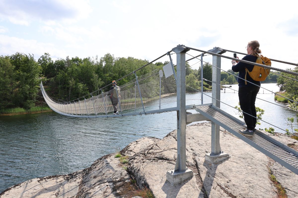
Photo: Niklas Kämpargård
Unique hiking experience in Blekinge
Eriksbergsleden is a new spectacular coastal hiking trail in the Eriksberg nature reserve that offers a unique hiking experience along Blekinge’s beautiful coastal landscape. The trail is the result of the previous trails, Allböleleden and Kohageleden, being connected with new bridges, creating a continuous stretch of approximately 12 kilometers for those who want to explore both nature and cultural history on foot. The bridges offer visitors a fantastic opportunity to explore the area’s dramatic coastal landscape and rich wildlife. The new connections make it easier than ever to hike in this part of Blekinge, which borders the well-known Eriksberg Hotel & Nature Reserve.

The suspension bridge at Boksundet
A coastal trail with nature and views
The Eriksberg trail winds through a varied landscape along the shores of Eriksberg, where the sea, forest and cliffs combine to create a dramatic and natural hiking experience. The terrain is varied, with rocky outcrops, narrow paths and sections where you easily feel completely alone with nature. The trail is also considered one of the most challenging in Blekinge. During the hike, you will pass areas where remnants of older cultural landscapes have been preserved and the route is lined with beautiful views of the open sea.
The bridges that connect the trail
A central part of the Eriksberg trail are the two new bridges that connect the previous trails and make it possible to hike the entire route:
- Boksundet, a 100-meter-long suspension bridge
- Kohagesundet, a 185-meter-long wooden walkway, connecting Kohagen with Dragsö
These bridges are not only functional – they are also spectacular features along the trail, offering beautiful views and experiences close to nature.
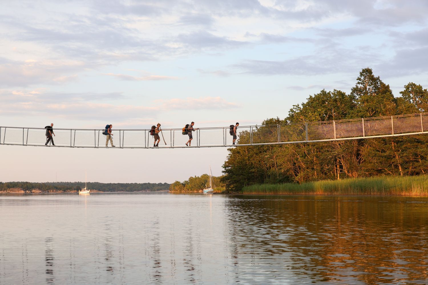
Photo: Niklas Kämpargård
Practical information for hikers
The Eriksberg trail has two starting points, depending on how you choose to hike the trail:
- Outdoor Eriksberg – parking and starting point at the safari park entrance (N 56°11’26” E 15°00’00”)
- Björnahemmet – the other end of the trail (N 56°10’15” E 14°59’03”)
As the trail is not a circular route, it may be convenient to use local transport via Blekingetrafiken from Karlshamn’s trainstation to get to the place where you want to start your hike.
You can also book transport via Eriksberg from the large car park at the farm shop Outdoor Eriksberg, through the safari park, to Björnahemmet. From there, you can start your hike eastwards along the Eriksberg trail back to your car at Outdoor Eriksberg.
During high season, you can combine your hike with a trip on the archipelago boat from Karlshamn or Matvik to Bruksviken pier, making the start of your hike even more scenic and flexible.
Along the trail there are also rest areas, barbecue areas and, on the western part, two newly renovated gun emplacements where you can spend the night if you want to extend your nature adventure. Read more about the Eriksberg trail and see a map of the area on Naturkartan.

The wooden footbridge by Kohagesundet

View from the gun emplacements

One of the gun emplacements along the trail Allböleleden
